Tag Archives: cool photo

Kakadu National Park

The next morning we drove southeast towards world-famous Kakadu National Park. Along the way we stopped at Fogg Dam Conservation Reserve. We hiked the excellent boardwalk along the Waterlily Walk, and Neil introduced me to the Water Plants:

After making their acquaintance, we continued on to the end of the boardwalk where we scoped a large, shallow lake. Highlights here were many dozens of elegant Pied Herons, and a vaguely ridiculous-looking Bar-breasted Honeyeater.

The dam itself was closed to hiking because of the presence of an aggressive saltwater croc, but we drove across it and checked out the Pandanus lookout, which was beautiful but not particularly birdy. Back in the car, we continued east to Mary River National Park where we stopped at the bird billabong and picked up Little Woodswallow and Yellow-billed Spoonbill.

Brilliant pink flowers near Fogg Dam

Back on the road, we crossed into Kakadu National Park. The Kakadu area has been home to aboriginal people for at least 40,000 years, and it was an honor to visit this sacred place. It is also the second largest national park in Australia at over 7600 square miles, and home to hundreds of bird species. My enthusiasm for arriving at this World Heritage Site was somewhat tempered in the late afternoon by the sweltering humidity and withering heat: mid-30s C (mid-90s F). Even Neil called it “bloody hot.” By the time we got to the Mamukala Billabong, I had to drag my limp and sweaty body from the car. I was rewarded with a couple of Crimson Finches, new for the trip, but then collapsed panting in the shade waiting for Neil to finish scoping the lake.

The sun was low on the horizon by the time we rolled into the tiny, dusty outpost of Jabiru and the grounds of the Mercure Kakadu Crocodile Hotel. On the down side, there was not much in the way of food or services in Jabiru, and everything (food, lodging, petrol) was exorbitantly expensive. But on the upside, we got to sleep inside a giant crocodile at this aptly named hotel.

The next morning, we headed over to Burrungkuy (formerly known as Nourlangie Rock). This majestic sandstone escarpment has some of the best preserved aboriginal rock art in the world. We spent the cool early morning looking for birds, and scored a couple new ones including the spectacular Black-banded Fruit-dove.

But as the morning warmed up and the birds became quiet, I spent more and more time studying the amazing rock art.

Some of these images were painted over the past 200 years, but the earliest ones are almost 4000 years old. They are a breath-taking window back in time into the ancient aboriginal Dreamtime.

The image below depicts Nabulwinjbulwinj, a “dangerous spirit who eats females after striking them with a yam,” according to a nearby inscription.

The traditional owners (a respectful way to refer to the native people of the area) tell visitors that the painting below narrates a story about Namarrgon, the Lightning Man (upper right) and his wife, Barrginj (center left).

We eventually tore ourselves away and returned to Jabiru to grab some lunch and do some birding around “town.” Thanks to a hot tip, we picked up the rare and local Partridge Pigeon at the Aerodrome. In the late afternoon we drove out to Ubirr where we tried (but failed) to connect with Sandstone Shrikethrush. We were consoled with beautiful scenery and more outstanding examples of aboriginal rock art.

Back at the Croc, we had a couple of beers and plotted the final chapter in our 2019 Australian adventure.

Leave a comment

Filed under Australia, Birding

Pitta Party

The Northern Territory of Australia is vast swath of land, home to very few people. It spans more than half a million square miles, almost twice the area of Texas. And it’s home to fewer people than Madison, Wisconsin. About one-quarter of the population are indigenous aboriginal people who have lived in the area for tens of thousands of years. The northern part of the territory is classified as tropical savanna, while the interior “red centre” is mostly hot and very dry desert. Neil and I were planning to spend the first few days around Darwin, picking up few costal specialties, and then work our way south through world-famous Kakadu National Park and down into the real Outback, as far as Pine Creek or Katherine.

Our first morning in the NT, we arrived at Buffalo Creek just before dawn. The Buffalo Creek management area is 20 minutes north of Darwin. It protects valuable wildlife habitat along the banks of lower Buffalo Creek where it empties into the Timor Sea. This area can experience dramatic tidal changes of up to five or six vertical meters (nearly 20 feet!) in the span of about six hours, so we had consult a tide table to make sure that our birding area would not be underwater. Fortunately this week the difference between high and low tides was a more manageable three meters (about 10 feet), and sunrise corresponded roughly with low tide. We would have to keep an eye on the time and the tides, though. I’d heard that they wait for no man, and we didn’t want to swim back to the car.

Also, swimming back to the car would be a terribly bad idea. The area’s saltwater crocodiles are extremely dangerous, and have been known to kill and eat humans.

The very long boat ramp provided some dramatic evidence of just how much the tides could change. We found the start of a trail, and began working our way into the forest. It was tough going through the dense mangroves, and several times we had to ford small creeks or navigate around them.

Muddy silt and dripping mangrove leaves reminded us that this entire area was underwater a few hours ago.

The cool morning air was alive with birdsong. We quickly picked up a couple dozen species, quite a number of which were new for our trip including Arafura Fantail, Mangrove Gerygone, Red-headed Myzomela, Rufous-banded Honeyeater, and Varied and Red-collared Lorikeets. Chestnut Rail, a shy specialty of the area, eluded us.

After more than an hour in the forest, we returned to the beach area and noticed a large flock of birds along the waterline. We had to trek across an expanse of sand to get close enough to identify them, but soon we were looking at a giant mixed flock of shorebirds and seabirds.

During the next half an hour we sorted through six species of terns, including Little, Lesser Crested, and Whiskered, and 13 species of shorebirds including Lesser and Greater Sand-Plover, Great Knot, Red-capped Plover, Common Sandpiper, Common Greenshank, and Far Eastern Curlew. Nothing escaped Neil’s sharp-eyed seabird scanner, and he was picking out a couple of offshore Brown Boobies while I perused the seashells washed up on the beach.

Returning to the car, we realized that had notched almost 50 species, 16 of which were brand new for our trip. There is something magical about birding a totally new geographical location. A fresh, unknown experience is always just around the corner. At this point the sun was rising higher in the sky, the tide was inbound, and we had other places to check out before the oppressive heat of the afternoon descended.

The forest trail along nearby Lee Point had been recently subjected to a controlled burn (a not uncommon practice in the Top End), but we still managed to find a couple species of cuckooshrikes and a spectacular Rose-crowned Fruit-Dove. On the way back to the car, Neil was distracted by yet more shorebirds, which we were curiously unable to identify down to species.

Our next stop was the East Point Reserve. By this time the sun was high in the sky, and temperatures had reached the mid 30s C (mid-90s F). The Monsoon Forest Walk was supposed to be good for Rainbow Pitta, a bird that both Neil and I were very keen to see. Monsoon forest is a dry tropical forest biome which experiences a long, hot dry season and then heavy rains. We were in the middle of the “cooler” dry season, but it wasn’t feeling so cool right now. Before setting out, we refreshed ourselves on the Pitta’s distinctive call: a loud, multi-syllabic squawk that is often transliterated as “I WALK to WORK!” Entering the forest, we found ourselves surrounded by a still quietude, punctuated only by our footsteps crunching through the dead leaves. We hiked all of the primary trails, covering a mile and a half in one hot, sweaty hour. We had seen only a handful of birds total, although two of them (Green-backed Gerygone and White-gaped Honeyeater) were new for our trip. The White-gaped Honeyeater completed our set of white-embellished honeyeaters, as we had previously ticked the White-eared, White-cheeked, White-throated, White-plumed, and White-naped. I’m not impressed with Australian ornithologists when it comes to their creativity in naming honeyeaters.

A couple of times I thought I heard a Pitta-like “WALK” calling in the distance, but decided that it was either wishful thinking or auditory hallucinations brought on by the fact that my water bottle was empty and my body temperature was rising. I thought heard it again… up ahead, something was calling. Rounding the next bend in the trail, I paused to listen. Instead of hearing another bird call, I heard the faint rustle of a small creature walking or hopping through the dried leaves. Neil caught up, and that’s when we spied the Pitta.

Rainbow Pitta – photo by Neil Hayward

It was spectacular. More colorful and vibrant that I had even imagined. I held my breath, certain that it would instantly vanish back into the forest. But it didn’t. The Pitta was not in any hurry to go anywhere. It sauntered around on the ground, up into a low bush, and then back to the ground.

Rainbow Pitta – photo by Neil Hayward

We watched it for a good 15 minutes before it eventually slipped back into the forest. Despite the fact that we had hardly moved, I felt out of breath. Realizing that I had been alternately holding my breath and breathing very slowly and shallowly, I took a moment to take some deep breathes and give some high fives. We finished our walk, and then headed out for a well-deserved lunch and some cold drinks. In the late afternoon we checked out East Point, and then returned to Buffalo Creek where we picked up Broad-billed Flycatcher and a fly-by Torresian Imperial-Pigeon. Nothing could match our encounter with the Pitta, which turned out to be one of the highlights of our entire trip.

Leave a comment

Filed under Australia, Birding

The Canyons Keep Calling Me Back

It’s spring break, which means some folks are headed to Myrtle Beach.  Some lounge around on the couch and watch a lot of TV.  One teacher friend of mine curled up with a big stack of English papers and a green pen (yikes!).  I traveled to southeastern Arizona for some quality time alone in the deserts and canyons.

Saguaro National Park

Well, not alone exactly – I went to spend some time with the birds of the arid Southwest.  April is a great time to visit.  The weather was beautiful during my trip, mostly sunny with highs in the 70s to 80s depending on the elevation.  I have to say that even though it is more pleasant temperature-wise in April, not all of my favorite birds are really back yet from their wintering grounds (I’m looking at you, Red-faced Warbler!).  May, and even late July and early August score slightly higher on the cool bird index.  Still, it was a great week here in Arizona.

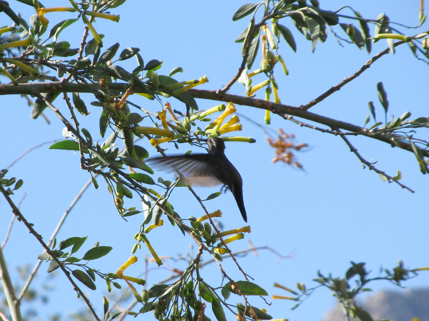
Magnificent Hummingbird

Hummingbirds were a highlight.  I’ve seen nine species, which isn’t too bad.  A late summer visit can net you 12-15, depending on how many rare ones are about.  The one pictured above is the aptly named Magnificent Hummingbird.  Light refracts off of special feathers on its head and neck giving rise to amazing iridescence in the sunlight.  Even in the shade, they can look pretty remarkable.  The one below is a male Broad-billed Hummer.

Broad-billed hummingbird

While the deserts have a few specialty species, many hummingbirds are found at slightly higher elevations.  I had some good hummingbird watching in Madera Canyon, Miller Canyon, and Ramsey Canyon.  Speaking of the canyons, another one of my favorite canyon birds is the Acorn Woodpecker.

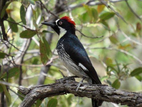
Acorn Woodpecker

They look (and act) just like clowns.  I love to watch their noisy antics.  Acorn Woodpeckers are a fascinating species.  They often live in loose colonies, and practice cooperative breeding strategies in which not only the two biological parents but also other members of the colony participate in raising the young.  The colony also usually maintains a “granary tree” – which is a tree or snag that is used for storing copious numbers of acorns.  A woodpecker drills a small hole, and then stuff a single acorn in so that it fits tightly.  A granary tree many contain thousands of cached acorns.

While I was in Ramsey Canyon at the Nature Conservancy preserve there, I noticed that the next door Ramsey Canyon Inn is for sale.

Photo Apr 07, 7 36 44 AM

I’m very happy as a teacher, but in my daydreams I think it would be awesome to cash in all my savings and run a birder’s B&B somewhere.  It’s probably a ton of work, and not nearly as much fun as it seems in my dreams.  But it gives me something nice to think about as I drift off to sleep here in my last night in Tucson.

Lest you think that my days were all filled with fun and frivolity, I want to set the record straight.  Birding in Arizona is a highly perilous affair, with dangers lurking around every corner.  Take for example, the sign I saw in Florida Canyon, south of Tucson:

Photo Apr 04, 7 32 44 AM (1)


I was lucky to escape with my life.  And even luckier to see a pair of very rare Black-capped Gnatcatchers building a nest.

Despite finding most of the birds I was looking for this week, one particular Arizona species has been giving me trouble for years – and this trip started no differently.  When you’ve been birding in Arizona as many times as I have, there aren’t many birds left to see here for the first time.  But when I arrived, there was one on the rare bird alert that had managed to escape me during all of my previous trips: Rufous-backed Robin.  These birds are quite uncommon, but there are usually multiple individuals sighted each year.  They are most likely to appear in winter, however, and I usually visit in the spring and summer.  Also, they can be very sneaky and skulky.  I have looked for them on multiple occasions – perhaps 7 or 8 times in total.  But they had always eluded me.  These Robins are, in short, my nemesis bird.

The week before I left Seattle, I noticed that a particular Rufous-backed Robin had been hanging out at Catalina State Park for several months.  Nemesis bird, prepare to meet your match!  Actually, the Robin lived up to its nefarious reputation.  I spent nearly four hours scouring its last known location on my first morning in Arizona, but it was a complete no show – and it hasn’t been seen since.  Damn you, robin!

Then, last night, as I was deciding about what to do with my last full day in Arizona, I saw another report of a Rufous-backed Robin.  This one was in Cienega Creek Preserve, a protected natural area just south of Tucson.  I had never been there before, in part because a permit is required just to enter the preserve.  I didn’t have a permit.  But I found that you can apply for one online; three hours later, the completed permit was emailed to me.  I was headed to Cienega!

The day dawned cool and cloudy.  I parked at the Preserve’s dirt parking area about 20 minutes after sunrise.  I placed a copy of my permit on the dashboard, and headed off down the trail.  Cienega Creek Preserve is spectacular.  The trail winds through a vibrant Sonoran desert scrub.  I had to shuffle my feet to keep from stepping on several coveys of Gambel’s Quail as I was serenaded by Cactus Wrens and Bell’s Vireos.  About two miles in, the trail entered an extensive stand of cottonwood trees, and the creek began to flow faster and deeper.

Cienega Creek Preserve

The cool air was scented with sage, cottonwood blossoms, and sweet petrichor.  I arrived at the place where the Robin was last seen, and began to search.  And search.  And search some more.  Then I took a break.  And a walk.  And had lunch.  And searched some more.  Suffice it to say that there were no robins on the trail this day.  Part of me was pretty disappointed that my nemesis bird had again somehow escaped my grasp.  But part of me was also deeply grateful that I keep missing these birds.  If I hadn’t been tempted by the prospect of maybe meeting my nemesis, I never would have bothered applying for a permit to visit this unique and beautiful area.  And I never would have gotten to know this special place.  My nemesis taunts me, sure.  But it also encourages me and inspires me, goads me on and fires my determination.  So laugh, robins, laugh while you can.  On my next visit, I’m going to hunt you down.

And thus ends this visit to Arizona.  I don’t know exactly when, but I’ll be back in the not too distant future.  There is always more to see.

Cactus flower

1 Comment

Filed under Birding

Denali

Denali landscape

I had heard a lot about Denali National Park in Alaska, but none of that prepared me for the sheer magnitude and majesty of this place.  Denali is six million acres of protected wilderness in the midst of some of the most breath-taking geology in all of North America.  Almost everything about it is at least a little fantastical.

Denali peekaboo

For starters, I’m just a couple hundred miles south of the arctic circle.  Sunset tonight is at 11:51pm, which is followed by several hours of twilight, and then sunrise again at 3:51am.  The sun rises in the north (NNE, actually) in an almost horizontal motion, slowing creeping above the horizon.  After five hours or so, the sun is halfway up in the eastern sky.  By midday (five hours after that) it’s swung around nearly overhead and slightly to the south.  For the next 10 hours it treks westward and then northward, finally setting again in the NNW, not too far from where it rose.

Even though tomorrow is the first day of June, in some ways it still feels like winter here.  The Denali lowlands got 9 inches of slow last week.  While daytime highs have been climbing into the 70s, I see ice and snow all around me, sometimes several feet deep.

Denali landscape

Just getting here was an adventure.  Denali is 250 miles north of Anchorage, most of it on a two-lane road, the George Parks Highway.  I was swerving around moose in the middle of the road less than 10 minutes from the Anchorage airport, and things only got wilder from there.  On my journey north, I could see that spring is indeed late this year.  Many of the rivers were still in various stages of breakup, as the long winter’s ice cracked and buckled under the warming sun and the surrounding rush of meltwater.

River Breakup

I stood on the bridge over this river, and watched icebergs of various sizes and shapes float by, as thunderous cracks upstream heralded the arrival of new chunks of loose ice barreling downstream.

River ice

I stayed in the tiny town of Healy, about a dozen miles north of Denali’s main entrance road.

Healy

Aside from this sign, there are a few hotels, two restaurants, and one gas station in Healy.

There are a couple of different ways to experience Denali National Park.

Me at Denali

There is a visitor’s center and some trails right at the entrance, and you can drive in the first 15 miles on the park road in your own car.  But if you want to go beyond the Savage River at milepost 15, you need to take an official park shuttle or bus.  The narrow and sometimes treacherous road that snakes west for 92 miles just isn’t built to handle the 400,000 people who visit Denali annually.  I bought a ticket to Toklat at MP 53; the road beyond that was still closed due to snow.  At 7am, I boarded the bus for the seven-hour round trip.

Denali bus

While Denali does have some interesting birds, the highlight here is mammals.  And what a highlight they are!  In two days, I got great looks at Dall’s sheep, moose, caribou, collared pika, hoary marmots, snowshoe hare, arctic ground squirrels, a gray wolf, and a lynx.

Arctic Ground Squirrel

Arctic Ground Squirrel

Snowshoe Hare

Snowshoe Hare – still turning from his winter whites to his summer browns

Dalls sheep

Dall’s sheep, with babies

Caribou

Caribou

Bad moose

WHY did my camera freak out and refuse to focus right when mama moose and her two cute mooselings appeared right next to the road??  I guess I’ll never know.

While Denali is the best place in North America to see large mammals, I saw a few birds too – including possibly my new favorite bird, the Willow Ptarmigan.

Willow Ptarmigan

They are just so comical and charismatic, perched in the top of spruce trees and muttering their cackling chicken-language under their breath.  I found them utterly charming.

Willow Ptarmigan in the rain

Even aside from the animals, there was so much to look at in Denali.  The landscape itself was breath taking.


Denali landscape

I even got to see Denali itself (or Mt. McKinley, as the U.S. Congress still insists on it being called).  This 20,320 foot peak is the tallest in North America.  During the spring and summer months it’s often wrapped in clouds (it creates it own weather), but for a few hours yesterday you could see its glaciated summits.

Denali

And this was from some 80 miles away!  Later it rained, and I got to see my first Denali rainbow.

Denali rainbow

With near 24-hour daylight, it’s tempting to stay up all night walking the trails, reading my book, or planning the rest of my Alaska trip – but I think I will force myself to go to bed now.  It’s been 3 days since I’ve seen darkness (the blinds in my room don’t close all the way), but my body still needs sleep.  I think.  Right?

3 Comments

Filed under Birding

The Colima Warblers of Big Bend

I will confess that I didn’t come to Big Bend just for the scenery.

Toll Mountain

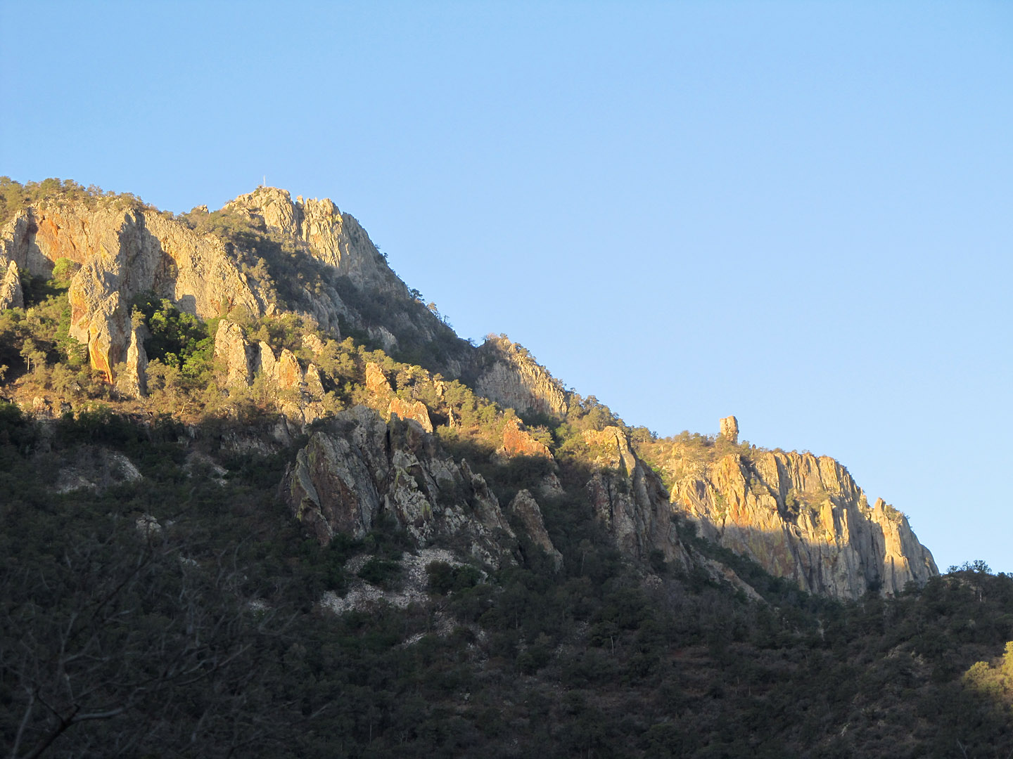
I also came to search for the Colima Warbler.  There are about 52 regularly occurring species of wood warblers in the US and Canada (depending on how you count), and I have already seen 48 of them since June of 2012.  The three hardest to get are the endangered Kirtland’s Warbler (check), the south-of-the-border vagrant Rufous-capped Warbler (check), and the Colima.  Colima Warblers are not endangered like Kirtland’s, but almost all of their natural range lies south of the Rio Grande.  Perhaps a few dozen trickle across the border to breed in the high altitude mountains of Big Bend.  In order to see a Colima, though, you need to hike up to where they live.

Up there.

To Pinnacles Trail

It’s not a trek for the faint of heart.  The traditional spot to find Colimas is Boot Spring, about 9 miles roundtrip from the trailhead in the Chisos Basin.  The hike starts at over a mile above sea level, and climbs another 1800 feet or so, mostly in the first 3 miles.  Not being as physically fit as some hikers, I started before dawn so I could reach the Colima’s habitat while they would still be active and singing in the cool mid-morning hours.

I started up the Pinnacles Trail.  The turnoff to Boot Spring is just past the junction with the Colima Trail.

Pinnacles Trail Sign

On the way up I listened to many calling Gnatcatchers, and admired the blooming cacti.

Cactus

The trail is well-maintained, although it is steep and rocky in places, and the switchbacks near the crest are tiring.

trail

As I climbed, I could see out over the entire Chisos Basin area.  The morning sun bathed everything in a golden glow.

Halfway up Pinnacles Trail

I stopped to rest and eat a little trail mix, and a chummy group of Mexican Jays came down to request that I share some peanuts with them.  They were not pleased when I refused.

Mexican Jay

Looking up, I could see the Pinnacles formation.  The end of the strenuous climbing portion of my hike was in sight.

Pinnacles

Near the top, I heard a warbler singing!  It took me a few minutes to track it down, but then I saw it: a large brownish-gray warbler with orange undertail coverts.

Colima Warbler

That’s birder-speak for “it has an orange butt.”  Going a little higher, I got a slightly better view of the rest of him while he was busy singing.  Note the white eye-ring and the faint chestnut cap.

Colima Warbler

Yes, my point-and-shoot camera was not quite up to the job here, but I got a few ‘record shots.’

I climbed the rest of the way to the top, and ate a congratulatory granola bar while I enjoyed the view.

View from top

I hadn’t made it to Boot Spring yet, so I decided to keep going.  The trail leveled out a bit here, so the hiking was much easier.  And I could start to see the other side of the Chisos Mountains.

Other side of Mtns

After another mile or so, I saw Boot Rock (in the foreground):

The Boot

Boot Rock, of course, looks like an upside down cowboy boot – and gives its name to Boot Canyon and Boot Spring.  Boot Rock is a hoodoo, a tall vertical rock formation left behind when the softer rock around it weathered and eroded away.

Near Boot Spring I found many of the expected high elevation birds: tanagers, flycatchers, and vireos – but no more Colima Warblers.  It was later in the day by this point, so it’s possible they just weren’t singing as much anymore.  I also found this guy lounging in my path.  I believe it’s a Texas Alligator Lizard.  It was quite large, and not very reluctant to get out of my way.

Texas Alligator Lizard

I didn’t make it all the way to the South Rim, but my various exploratory excursions and back-tracking amounted to at least 11 to 12 miles, by my rough estimation.  My feet were killing me by the time I got back down, and I had managed to consume all 2.5 liters of water I brought with me.  I took a short nap, and got up in time for a big dinner and one more classic Big Bend sunset.

Sunset at Big Bend

Leave a comment

Filed under Birding

Big Bend National Park

Toll Mountain

Despite leaving Seattle over a week ago, this is my first blog post of my trip (and I’m going home tomorrow!).  My lack of productivity on the blog front is due to two factors.  The first is that I spent the first four days on an odyssey to Big Bend National Park, a place of spectacular geology and surprising biodiversity – and extremely limited internet availability.  The second factor is that I’ve spent the last couple days battling some of kind of nasty bug, which I thought might be Hantavirus or deadly Valley Fever, but my wife thinks is the stomach flu.  She’s probably right.  Again.  Thank goodness.

Anyhow, back to Big Bend.  Some places are in the middle of nowhere.  Not Big Bend.  In order to reach it, you have to first drive to the middle of nowhere, and then keep going for another couple hundred miles.  It’s at the End of Nowhere.  I’ve been lots of places during my travels this year with no cell phone service.  But I think Big Bend is the only place I’ve been with no cell service anywhere within 75 miles.

Big Bend Desert

Big Bend National Park encompasses an area over 800,000 acres, making it slightly smaller than Olympic NP and slightly bigger than Yosemite.  Yet not many people make it all the way out to Big Bend.  Olympic NP has 10 visitors for each one person who travels to Big Bend.  Great Smokey Mountains NP has 33.  I had to traverse four time zones just to get here: leaving Seattle (PDT), arriving Tucson (MST), driving through New Mexico (MDT), and finally traveling south through the Trans-Pecos region of Texas (CDT).  I was confused and exhausted arriving in Van Horn, TX for the night, as it was an hour later than I thought it should be.  It turns out that Texas has 254 counties, 252 of which are on Central Time and 2 of which are not.  Really, Texas?!

But the trip was worth it, for the scenery alone.

Big Bend Mtns

Big Bend Mtns

Big Bend Mtns

Knob

Unfortunately, these tiny pictures do not begin to do justice to the vastness of the landscape and the sheer magnitude of the mountains.

And then there was the wildlife.  I was constantly reminded that I was in Black Bear and Mountain Lion country.

Mountain Lion Warning Sign

Bear Country Sign

I love how we’re supposed to both “avoid carrying odorous food” and also “carry out trash and left-over food.”  I totally understand the reasoning for each, but don’t you think trash and leftovers might qualify as “odorous food”?

Returning from a hike, a ranger asked me if I’d seen any mountain lions.  I said no.  She said, “well, you can bet that one saw you!”  Then she pointed to the bear and lion tracker:

Bear and Mtn Lion Sightings

While unfortunately (or fortunately?) I didn’t run into any large carnivores, I did find plenty of wildlife.  Javelinas (Collared Peccaries) made an appearance every evening.

Javelina

A pair of Common Blackhawks were nesting near the Rio Grande.  My photo of the birds themselves didn’t come out (it was almost sunset), but here’s their personal sign:

Black Hawk Sign

A Greater Roadrunner sat high in a dead tree and sang his mournful territorial song:

Roadrunner in tree

This female Blue-throated Hummingbird was squeezing in one more snack before bed.

Blue-throated Hummer

And tarantulas scurried across the desert, out for their evening meal:

Tarantula

Hot on their tail, tarantula hawks roamed the desert.  The tarantula hawk is a type of parasitic wasp that uses tarantulas as its nursery.

Tarantula Hawk

The female tarantula hawk stings a tarantula, which paralyzes it but doesn’t kill it.  The wasp then drags the tarantula back to its burrow and lays an egg inside.  When the egg hatches, the wasp larva eats the tarantula alive.  Yikes!  Tarantula hawks usually don’t bother humans, but their sting has been rated the #2 worst insect sting in the world by the Schmidt Sting Pain Index.  I stayed away from the tarantula hawks.  Far away.

While I’m always a sucker for interesting fauna, I spent a little time checking out the flora as well.  Agaves are common in Big Bend.

Agave

These succulents flower only once, at the end of their lives, sending up a huge stalks to pollinate their flowers and disperse their fruit.

Agave Stalk

Although they are sometimes known as “century plants,” most species of agave only live a couple decades or so.

My first full day in Big Bend was a feast for the senses, and I had to drag myself back to my room after enjoying an amazing sunset.

Big Bend Desert at Sunset

Big Bend Sunset

I needed all of my energy for tomorrow’s epic hike, to see one of the smallest birds in one of the most distant corners of one of the most remote national parks in the country.


Leave a comment

Filed under Birding

The Dry Tortugas

I spent the last five days first driving down the mainline Florida Keys and then travelling by ship to the Dry Tortugas, a set of low-lying islets about 70 miles off the coast of Key West.

Just traveling to Key West is a remarkable journey.  It is about three hours south of Miami on US 1, also known as the Overseas Highway.  The name is apt, as you can often see the Gulf of Mexico to your right and the Atlantic on your left as you traverse this relatively narrow two-lane highway.  The most impressive stretch is Seven Mile Bridge, a span that covers almost seven miles of open water between Knight’s Key and Little Duck Key.

Keys

The Keys hold a remarkable diversity of special wildlife.  I saw the endemic Key Deer, a miniature race of White-tailed Deer.  They stand about two feet tall at the shoulder, making them a little larger than a cocker spaniel.  There were also plenty of cool birds, including a rare Western Spindalis, Mangrove Cuckoo,  Black-whiskered Vireo, and the majestic Magnificent Frigatebird:

Magnificent Frigatebird

Frigatebirds are kleptoparasites, meaning that they steal food from other birds. They will wait until a smaller seabird like a gull or tern has captured a fish, and then harass it until it drops its prey.

I didn’t get too many photos of the mainline Keys because the weather was incredibly stormy.  Thursday was particularly crazy, when 4.14 inches of rain fell in the span of about four hours.  It was the fifth wettest May day ever recorded in Key West, and many of the streets were flooded by up to 18 inches of water.  As a reference for you Seattle folks, we only have three months where our average monthly precipitation is more than 4.14 inches (November through January).

Storms over the Ocean

On Friday, I joined Wes Biggs and Florida Nature Tours aboard the M/V Spree for a three day tour of the Dry Tortugas.

Spree

Wes is an extremely experienced and knowledgeable birder, and a real character.  He has a story for every occasion, and an opinion on pretty much every topic.  I really enjoyed getting to know him a bit on this trip.

It took about seven hours to motor out to the Dry Tortugas, about 70 miles west of our marina on Stock Island.  The Tortugas were first discovered by Europeans by Juan Ponce de Leon in 1513 as he explored the lands that were to become Florida.  He named them Las Tortugas because his men collected many sea turtles there for food; the adjective ‘dry’ was added later on nautical charts to indicate that they are too small and too low to provide any fresh water.  The three largest islands in the group are between 30 and 60 acres, with three or four other much smaller islets.  They sit just a couple feet above sea level.

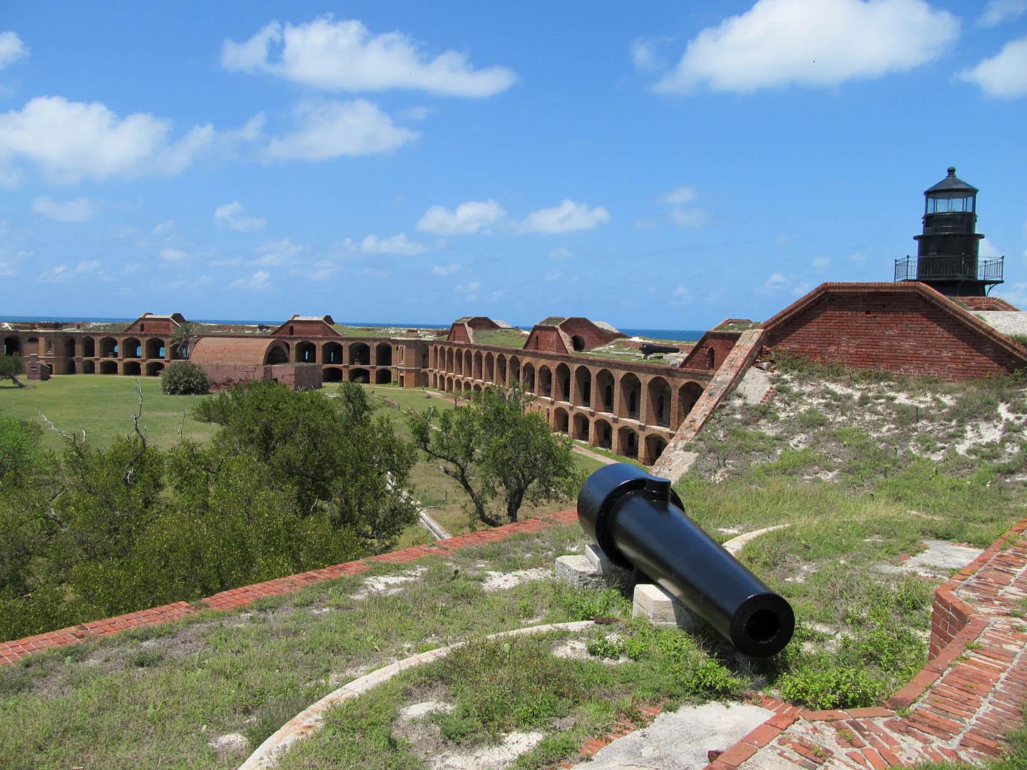
In 1846, the Federal Government began to build a fort on Garden Key, a construction project that continued for decades.  Fort Jefferson was never really finished, but it is an impressive edifice:

Fort Jefferson

It takes up more than 90% of the land area of Garden Key, and with 16 million bricks is the largest masonry structure in all of the Americas.  It was an active military base through most of the 19th Century, and was an important Union outpost during the Civil War.

Fort Jefferson Moat

Most famously, Fort Jefferson was where Dr. Samuel Mudd was imprisoned for a number of years after he was convicted of conspiring to kill Abraham Lincoln.  Mudd treated John Wilkes Booth’s broken leg after he assassinated Lincoln, and was alleged to have been involved in a plot to kidnap the president.

Dr Mudds Cell

Some claim that Dr. Mudd is the original inspiration for the expression “your name is mud(d)” – although this is disputed.  After he tried to escape, Mudd was sent to live in the dungeon:

Leaveth Hope Behind

Over time, his reputation changed somewhat.  Dr. Mudd was present during a yellow fever outbreak in the late 1860s, and helped to treat the many affected prisoners and soldiers.  He was eventually pardoned for his great medical efforts in 1869.

Today, Fort Jefferson is the heart of Dry Tortugas National Park, and one of the places we spent the most time on our three day trip.

Fort Jefferson Sign

The interior of the fort is filled with grass, trees, and bushes – the perfect stop-over point for trans-Gulf migrants on their way from the Yucatan or the Caribbean to the US mainland.

Inside Fort Jefferson

We saw a number of warblers, thrushes, vireos, and flycatchers who dropped in for a rest and a bite to eat, including this gorgeous Scarlet Tanager.

Scarlet Tanager

In addition to searching for passerines on Garden Key, seabirds were another focus of the trip.  One of my favorite is the large tropical tern called a Brown Noddy:

Brown Noddy

We saw thousands of Brown Noddies and Sooty Terns nesting on Bush Key:

Island Closed

Hey, someone needs to tell all those birds that this island is closed!

We also saw both Brown and Masked Boobies.  Hospital Key, not much more than a big sand bar, is the only nesting site for Masked Booby in the United States.  This Key was named during the yellow fever outbreak, when it served as a quarantine area.

Hospital Key

Those tiny white dots are the Masked Boobies.   A pod of dolphins also greeted us upon our arrival at Hospital Key:

Dolphin

We also visited Loggerhead Key, the largest of the Tortugas islands and the home to the Loggerhead lighthouse.

Loggerhead Key Lighthouse

Spree at Loggerhead

After three amazing days, it was time to head back to Key West.  The seas were a bit rougher than normal, and despite the many wonders I had witnessed I was ready to spend the night on dry land.  The Tortugas are a special place, and I hope to return some day with my kids to share its magic with them.

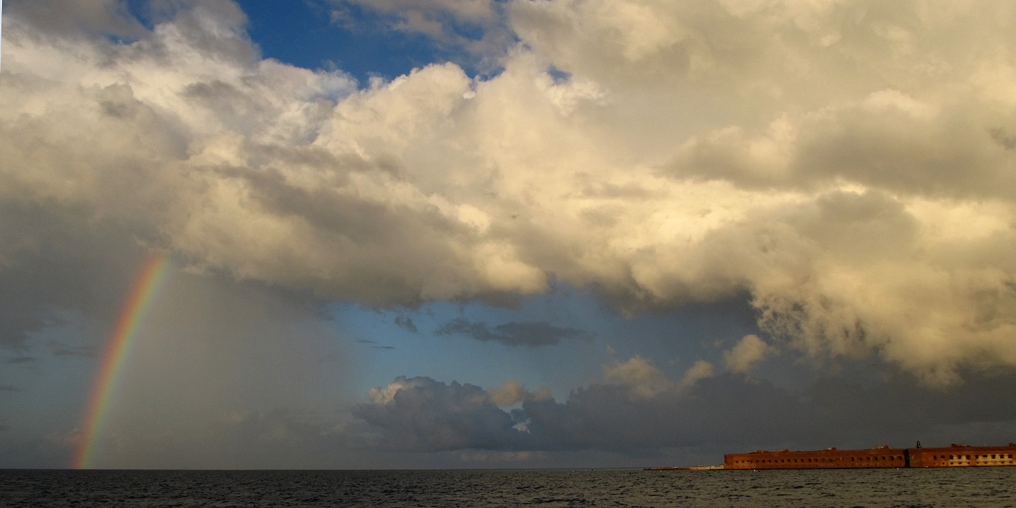
Rainbow over Fort Jeff


1 Comment

Filed under Birding

Deep in the Big Toe of Texas

If the Hill Country is the Heart of Texas, then the area around Brownsville and South Padre Island (in the extreme southeastern part of the state) is its Big Toe.  You know the one I’m talking about – that toe that always peeks out from the sandal, loves getting a good tan, and enjoys digging in the wet sand?  I’ve spent the last couple days exploring the Texas Toe, and seeing what it has to offer.

One of my first stops was the Sabal Palm Audubon Sanctuary, south of Brownsville.  There is not a lot of land in Texas south of Brownsville, but there is a thin little strip, and Sabal Palm is located there.  In order to get there, I’d have to take the most appropriately named Southmost Blvd.

Southmost

It was here that I came face-to-face with the famous (or infamous) Border Fence that the US Government has been building along our shared border with Mexico.  The fence is a scary monstrosity.  It is very tall, made of rusty-looking iron, and topped with spikes.  Trees, habitat, and farmland on either side have been cleared.  South of Brownsville the fence is actually built quite a distance from the Rio Grande, essentially sealing off a sliver of US land south of the border wall.  Sabal Palm Sanctuary is south of the fence, and you have to pass through a kind of checkpoint to reach it.

Border fence

border fence

I tried to put this unsettling experience behind me for now, and enjoy my time at the Sanctuary.  Sabal Palm is one of the few remaining tracks of wild habitat left in the eastern end of the Rio Grande Valley, and it is home to a forest of rare native sabal palm trees.  It is also a magnet for rare and beautiful birds.

I saw the rarest one first, a female Crimson-collared Grosbeak.  Common in parts of Mexico, this bird only very occasionally ventures as far north as the Brownsville area.  This particular individual liked to skulk deep in the brush while I was there, so all I managed was this less than serviceable photo:

CC Grosbeak

As you can see, her collar is green.  Only the male’s is crimson.  Her shy attitude and my persistent efforts to snap a photo made me feel a bit like one of those annoying photographers who is always trying to take a picture of some poor celebrity while she tries to get an ice cream with her kids.

The more common birds were more cooperative, like Green Jay and Hooded Oriole.  Bird snacks, provided by the refuge staff, helped them feel at home near the human visitors.

Green jay2

Hooded Oriole

That apple that the oriole was munching was popular, and as soon as he left a rare Clay-colored Thrush came in to have a bite.

Clay-colored Thrush

After spending a couple of hours at Sabal Palm, I negotiated my way back through the border fence and headed east to the coast.  Along the way, I scanned for Aplomado Falcons.

Aplomado Falcons used to be fairly common from south Texas to Arizona in the 19th Century, but perhaps because of cattle grazing, land clearing, and/or hunting, the birds were essentially extirpated (i.e. eliminated) from the United States.  In the 1980s, a re-introduction effort was launched, with captive-raised birds being released in southeast Texas.  The re-introduction seems to be working, and there are now a couple dozen Aplomado Falcons roaming wild in the area.  I have searched for Aplomados on every trip to Texas over the last ten years, including back in February when I was here.  This is my seventh trip overall, and I’ve missed seeing them on the previous six.  Birders call species that they miss repeatedly “nemesis birds” – and Aplomados were probably my #1 nemesis.  Needless to say, I wasn’t too hopeful.  There just aren’t that many of these falcons around, and they range over a wide area.  They are also relatively small, and they are fast flyers – easy to miss.  So when I saw a dark raptor zipping by me on Highway 100, I tried not to get excited as I pulled off the highway into the grassy shoulder (I had previously stopped for a distant Caracara and a couple of Chihuahuan Ravens, thinking they might be falcons).  Focusing my binoculars, I caught a quick glimpse of a sharp-winged falcon blasting by at perhaps 60 mph – in hot pursuit of some Horned Larks, one of which was about to become lunch on the wing.  It was an Aplomado Falcon.

Crappy Aplomado Pic

It was too fast and too far away to get a good photo, but here is a super blurry picture of this magnificent creature.  I watched it devour a Horned Lark, and then fly up to an electrical tower where there was a nest made of sticks.  And poking up from inside that nest was the tail of a second Aplomado Falcon, presumably sitting on eggs (or chicks!).  I had found an Aplomado nest!
Aplomado Nest and Tail

Aplomados have extremely long tails, mostly dark with thin white stripes – as you can see in the photo above!  I was thrilled.  I also decided I shouldn’t linger.  Even though I was still almost 200 yards away, birds of prey can get antsy when people get too close to their nests – and Aplomado Falcons are an endangered species.  So I did a little fist pump, put the car in gear, and headed for South Padre Island.

There’s more to tell about this leg of the trip, but it’s late and tomorrow is another early morning.  I doubt it can possibly top today, though.

1 Comment

Filed under Birding